
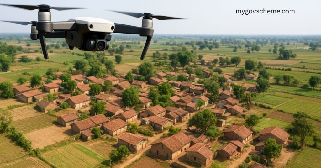
The SVAMITVA Yojana (Survey of Villages and Mapping with Improvised Technology in Village Areas) is a Central Sector Scheme launched by the Ministry of Panchayati Raj. It aims to provide rural property owners with a legal ownership record through Property Cards/Title Deeds by mapping land parcels using drone technology.
This scheme is a transformative step for rural India as it ensures proper land ownership rights, reduces disputes, strengthens rural planning, and provides financial stability by enabling villagers to use property as an asset for loans and credit.
In this article, we will cover:
- What is SVAMITVA Yojana?
- Objectives of the scheme
- Key features and benefits
- Eligibility criteria & exclusions
- Application process (step-by-step)
- Documents required
- Frequently Asked Questions (FAQs)
For readers looking for other government schemes, you may also check our detailed guides on National Pension Scheme, Mahila Samridhi Yojana, and Skill Loan Scheme.
What is SVAMITVA Yojana?
The SVAMITVA Scheme, launched on 24th April 2020 (on National Panchayati Raj Day), is a Central Sector Scheme implemented by the Ministry of Panchayati Raj in collaboration with Survey of India, State Revenue Departments, State Panchayati Raj Departments, and NIC.
The scheme involves mapping rural inhabited areas (Abadi lands) using drone surveying technology. Based on the survey results, villagers are provided with Property Cards (Title Deeds) that establish clear ownership rights.
📌 Full Form of SVAMITVA: Survey of Villages and Mapping with Improvised Technology in Village Areas
📌 Coverage: Around 6.62 lakh villages in India will be covered under the scheme in a phased manner over five years.
Objectives of SVAMITVA Yojana
The key objectives of SVAMITVA include:
- ✅ Creation of accurate land records – Helps in rural planning and reduces property-related disputes.
- ✅ Financial stability for citizens – Villagers can use their property cards as collateral for bank loans.
- ✅ Property tax determination – Enables states and Gram Panchayats to collect property tax efficiently.
- ✅ Survey infrastructure & GIS maps – leveraged by multiple government departments.
- ✅ Improved Gram Panchayat Development Plans (GPDPs) – GIS-based planning ensures effective utilization of funds and resources.
- ✅ Dispute resolution – Reduces land ownership conflicts and court cases.
Features of SVAMITVA Yojana
- Drone Surveying Technology: Drones used to digitally map land parcels in rural inhabited areas.
- Legal Property Cards: Each property owner receives a title deed certifying ownership.
- Rural Development Support: Helps in better planning for Gram Panchayats and state governments.
- Integration with Digital India: Promotes e-governance and modernization of land records.
- Nationwide Coverage: Covers 6.62 lakh villages across India by 2025.
Benefits of SVAMITVA Yojana
The scheme offers multiple benefits for rural households, local governance, and the overall economy.
1. For Rural Citizens
- Ownership rights through Property Cards.
- Properties used as collateral for loans.
- Reduction in property-related disputes.
- Increased security of tenure for rural households.
2. For Panchayati Raj Institutions (PRIs)
- Helps in better planning & implementation of GPDP.
- Enables property tax collection in devolved states.
- Provides accurate GIS maps for resource allocation.
3. For States & Central Government
- Establishes comprehensive land records database.
- Promotes transparent governance.
- Reduces burden of litigation and disputes.
Eligibility Criteria
✔️ The applicant must own property in a rural inhabited (Abadi) area.
Exclusions
❌ Agricultural lands not covered under this scheme.
❌ Properties outside Abadi areas are excluded.
Application Process of SVAMITVA Yojana
The SVAMITVA scheme follows a phased survey process. Villagers don’t have to directly apply online in most cases. Instead, the Gram Panchayat and Survey of India teams coordinate the process.
1. Pre-Survey Activities
- Permission is obtained to conduct surveys.
- A Gram Sabha is held to inform villagers about the process.
- Identification & marking of properties including government assets, Gram Sabha land, private properties, and open spaces.
- Issuance of public notification regarding the survey.
2. Survey Activities
- Setting up of CORS (Continuously Operating Reference Stations) network.
- Establishment of Ground Control Points (GCPs).
- Drone survey is conducted, followed by image processing to generate digital maps.
3. Post-Survey Activities
- Villagers are invited to raise inquiries/objections.
- Verification of land parcels and resolution of disputes.
- Issuance of Property Cards/Title Deeds to owners.
- Regular updating and storage of records.
- Capacity building and training of government officials.
Documents Required
- Identity Proof (Aadhaar Card, Voter ID, etc.)
- Ownership Proof (Existing records if available)
- Any other document as required by Revenue Officials
Frequently Asked Questions (FAQs)
1. What is SVAMITVA and what does it stand for?
SVAMITVA stands for Survey of Villages and Mapping with Improvised Technology in Village Areas. It provides integrated property ownership solutions for rural India.
2. When was the Pilot Phase launched?
The Pilot Phase was launched on 24th April 2020, on National Panchayati Raj Day.
3. What technology is used for land mapping?
Drone Surveying Technology is used for demarcating rural inhabited lands.
4. Why are collaborative efforts important for SVAMITVA?
The scheme involves collaboration between the Ministry of Panchayati Raj, Survey of India, NIC, State Revenue Departments, and Panchayati Raj Departments to ensure smooth execution.
5. What is the main objective of SVAMITVA?
The primary objective is to provide legal ownership records to rural property owners in the form of Property Cards/Title Deeds.
6. Is agricultural land covered under this scheme?
No, only Abadi land (inhabited areas of villages) is covered. Agricultural land is excluded.
Conclusion
The SVAMITVA Yojana is a historic step toward modernizing land records in rural India. By using drone-based technology, the government ensures transparent, dispute-free, and accurate ownership records. Villagers not only gain legal recognition of their property but also get the opportunity to use it as a financial asset for loans and development.
Over the next few years, as the scheme covers all 6.62 lakh villages, it is expected to bring a revolution in rural governance, planning, and financial empowerment.
If you want to learn about other government schemes for farmers and entrepreneurs, check out:
- PMEGP Yojana – Loan for Small Business
- Skill Loan Scheme
- National Pension Scheme for Traders and Self-Employed Persons
Stay updated for all schemes on mygovscheme.com!


